Log in
All resources
Create a design
1,095,866 Free Images of Maps Of Rinteln
maps in the library of congress
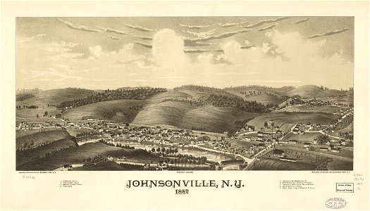
l. r. burleigh
new york
town maps by l. r. burleigh
1887 maps of new york (state)
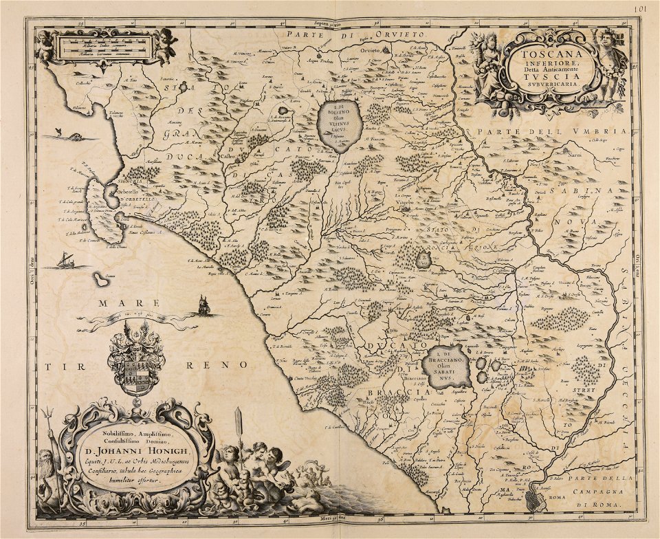
maps made in the 17th century
maps of the french and indian war
braddock road (braddock expedition)
charts and maps of the royal museums greenwich
1768 maps
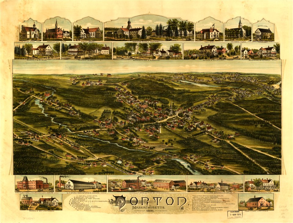
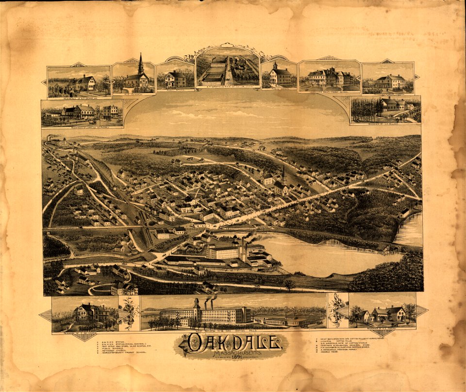
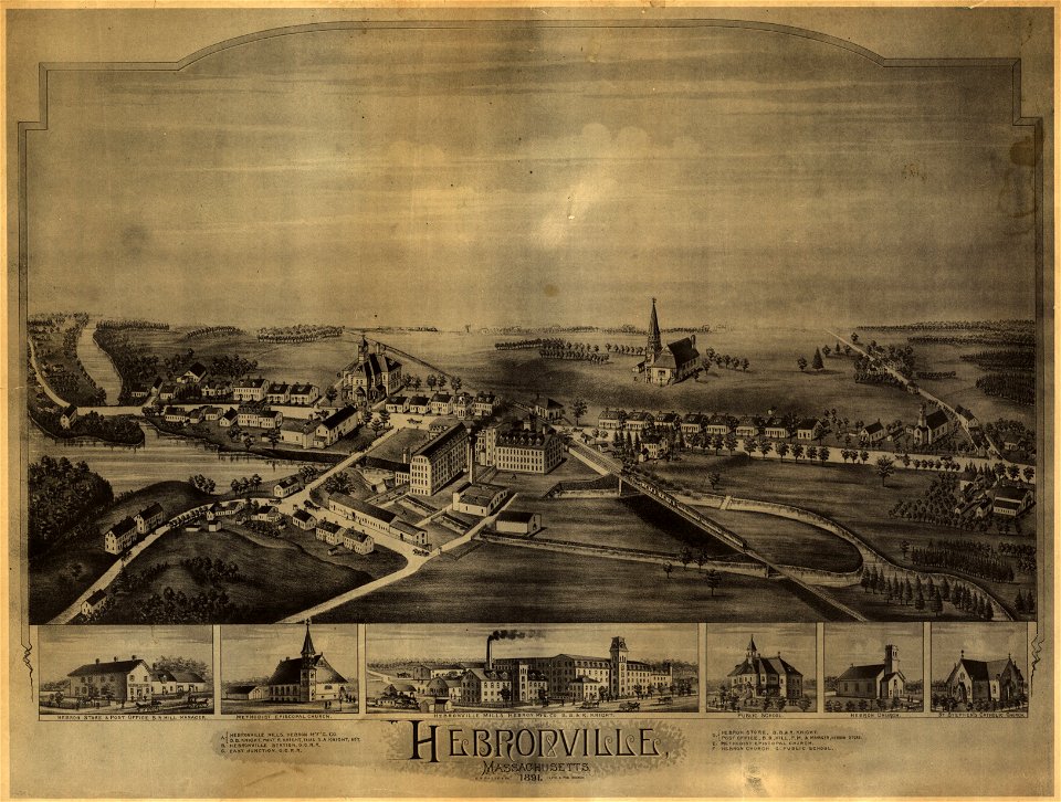
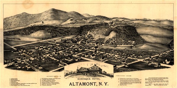
o. h. bailey
1891 map
massachusetts
oakdale
massachusetts
oakdale
university of toronto wenceslas hollar digital collection
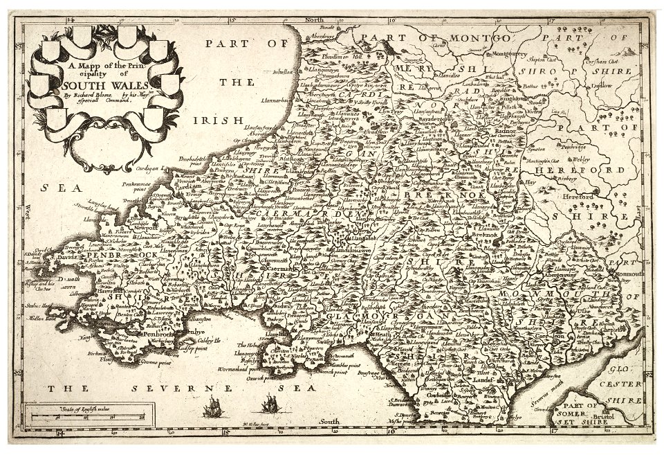
old maps of wales
maps by alexandre vuillemin
old maps of paraguay
maps in the library of congress
l. r. burleigh
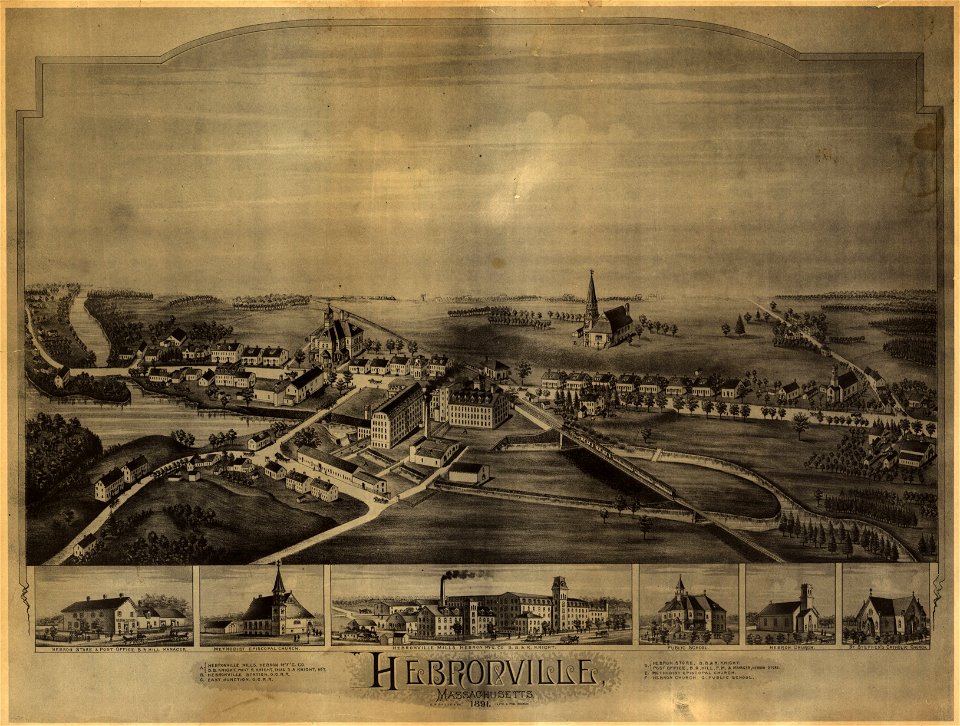
o. h. bailey
1891 map
o. h. bailey
1891 map
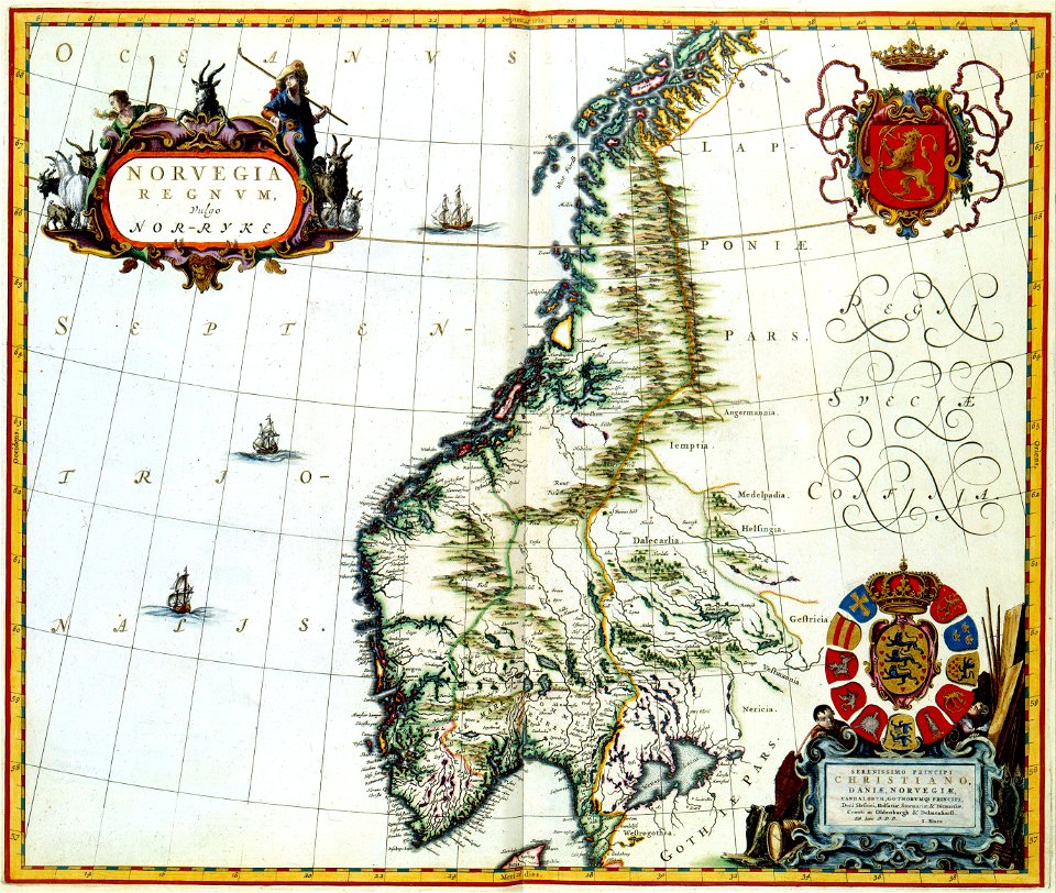
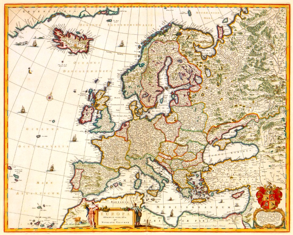
maps by willem and johannes blaeu
ravelins
pictorial maps
barbados
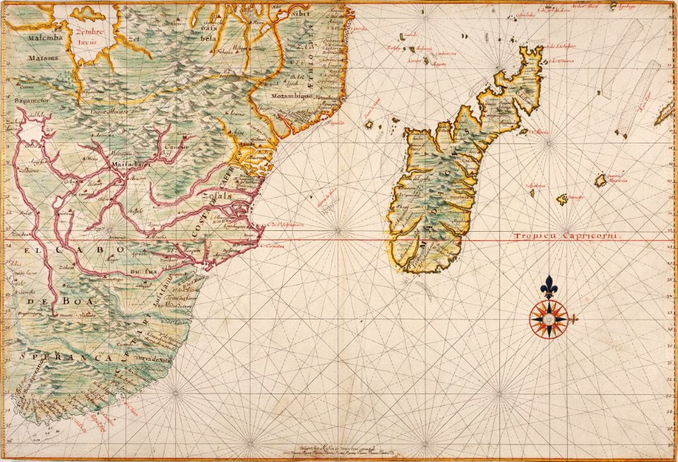
maps of the dutch east india company - madagascar
1665
maps of the dutch east india company - indonesia
1705
maps with cartouches
joan blaeu
maps with cartouches
atlas van der hagen
cornell: persuasive cartography: the pj mode collection
cornell university library
maps made in the 17th century
lochaber
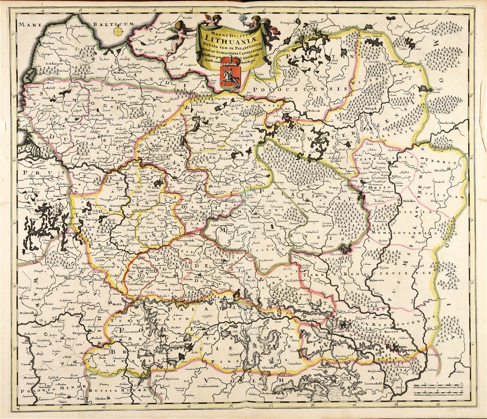
old maps of the grand duchy of lithuania
maps made in the 17th century
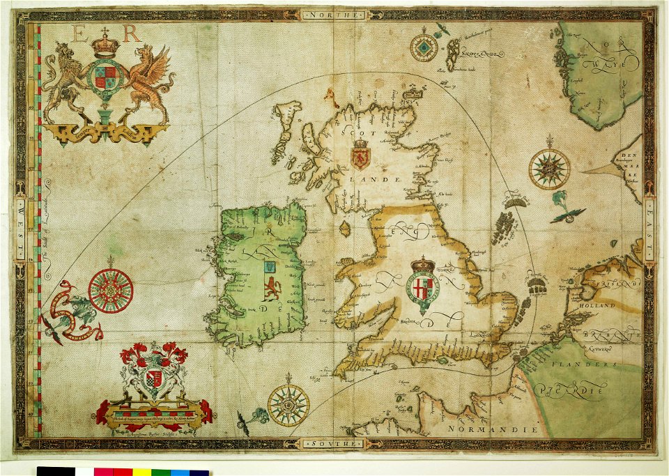
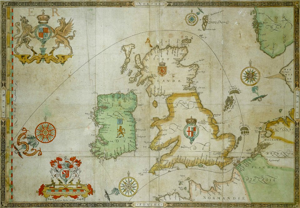
the track of the armada around britain and ireland
charts and maps of the royal museums greenwich
the track of the armada around britain and ireland
charts and maps of the royal museums greenwich
files from the bodleian libraries
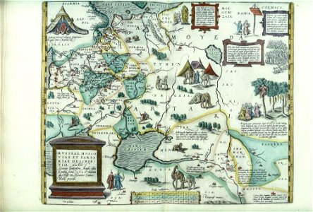
maps of tartary
parklandschaft klein-glienicke
königstraße (berlin-wannsee)
maps made in the 18th century
johann baptist homann
johann baptist homann
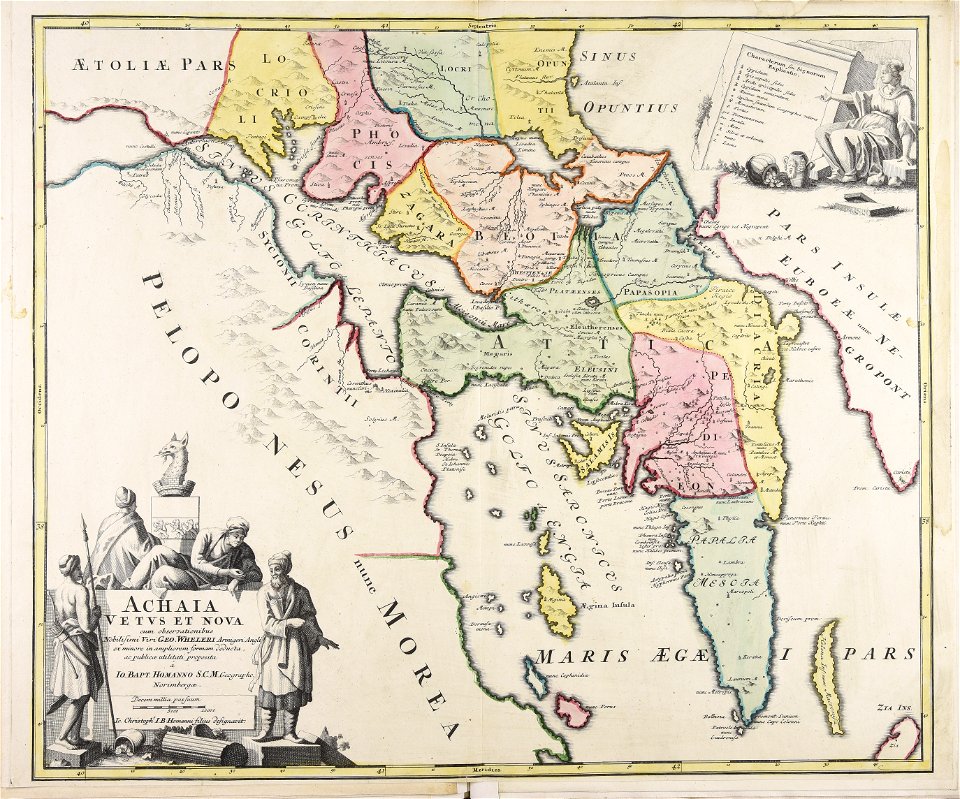
old maps of greece
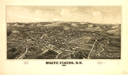
maps in the library of congress
new york
new york
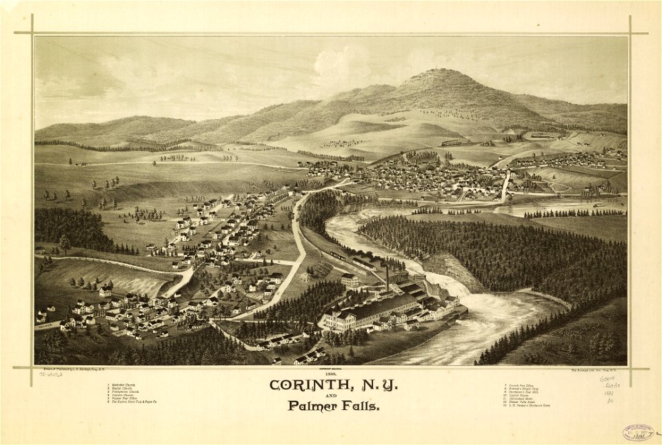
corinth
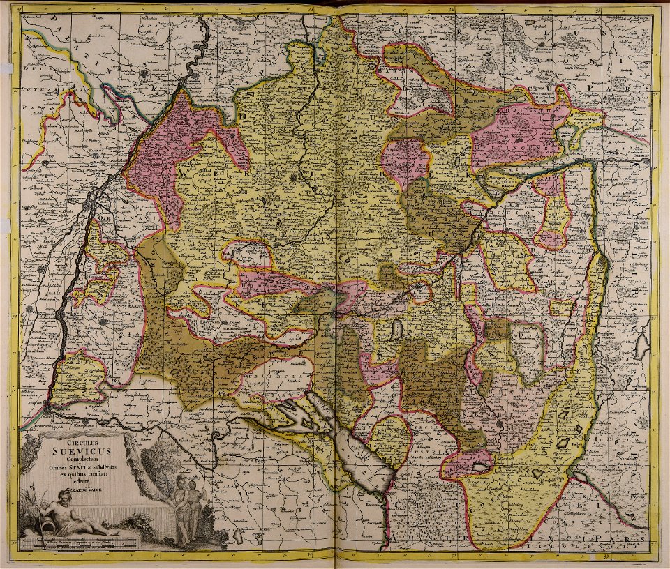
maps made in the 18th century
gerard valck
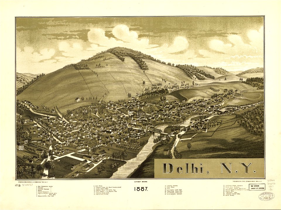
new york
delhi
maps with cartouches
copper engraving
new york
altamont
maps in the library of congress
new york
maps made in the 17th century
jan janssonius
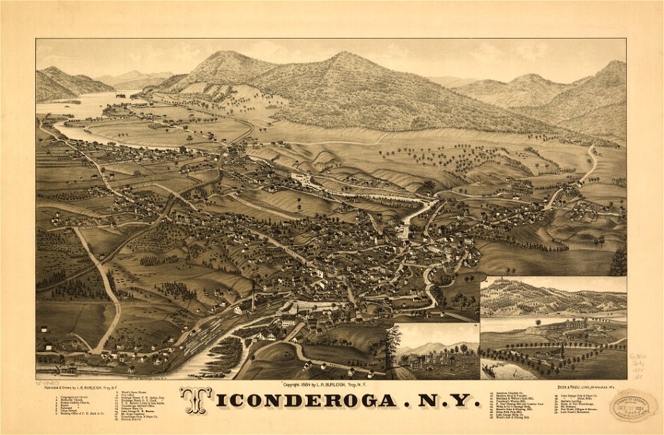
ticonderoga
new york
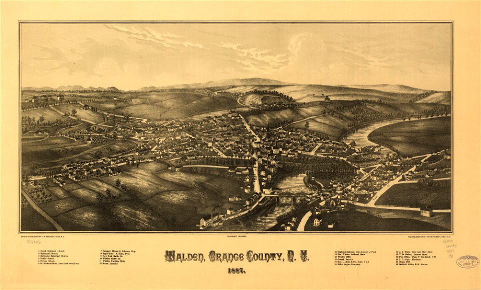
new york
walden
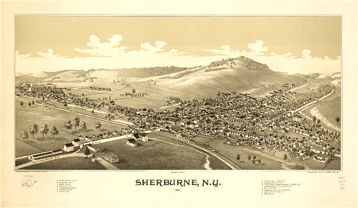
sherburne
new york
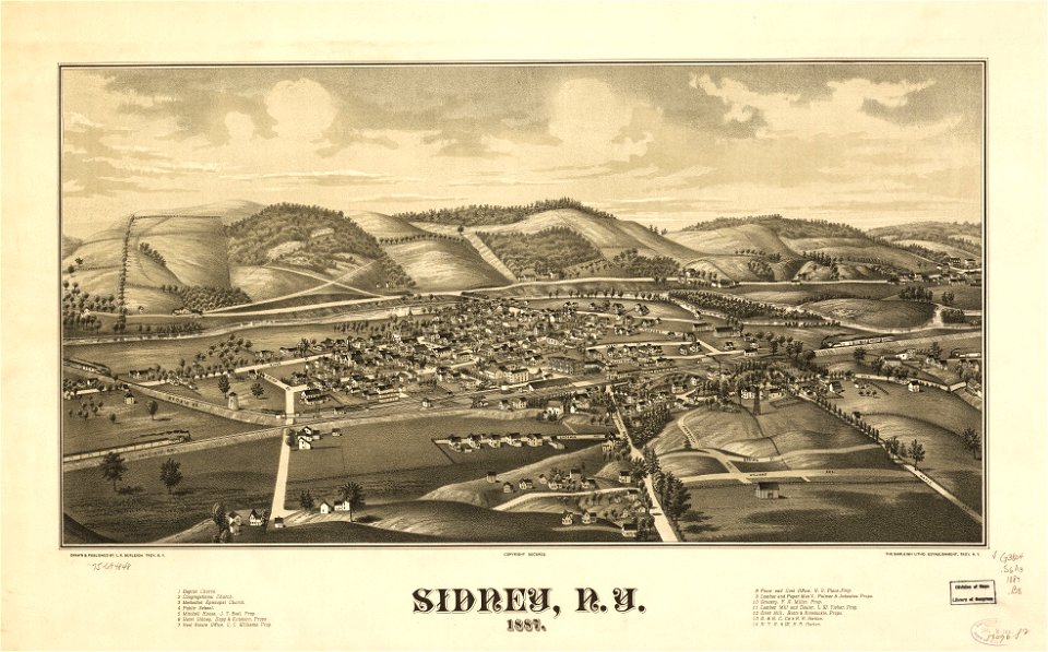
new york
sidney
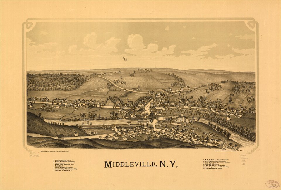
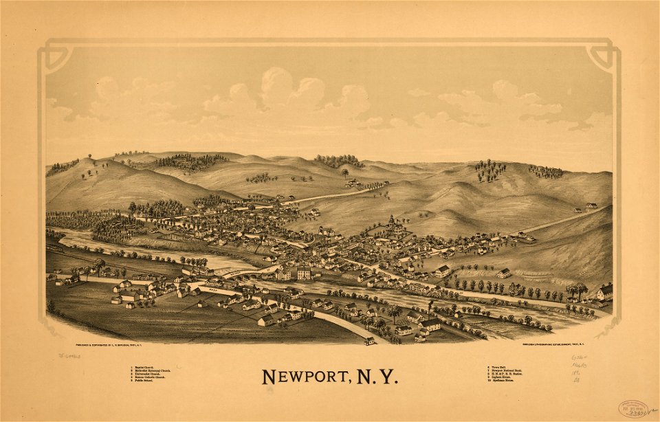
maps in the library of congress
new york
new york
newport
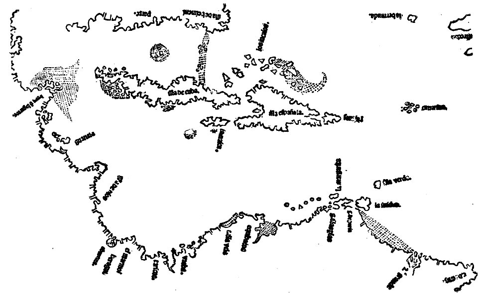
images from the john carter brown library
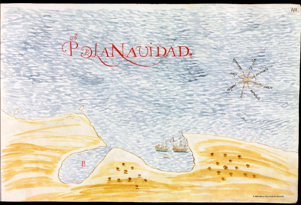
1500s maps of the caribbean
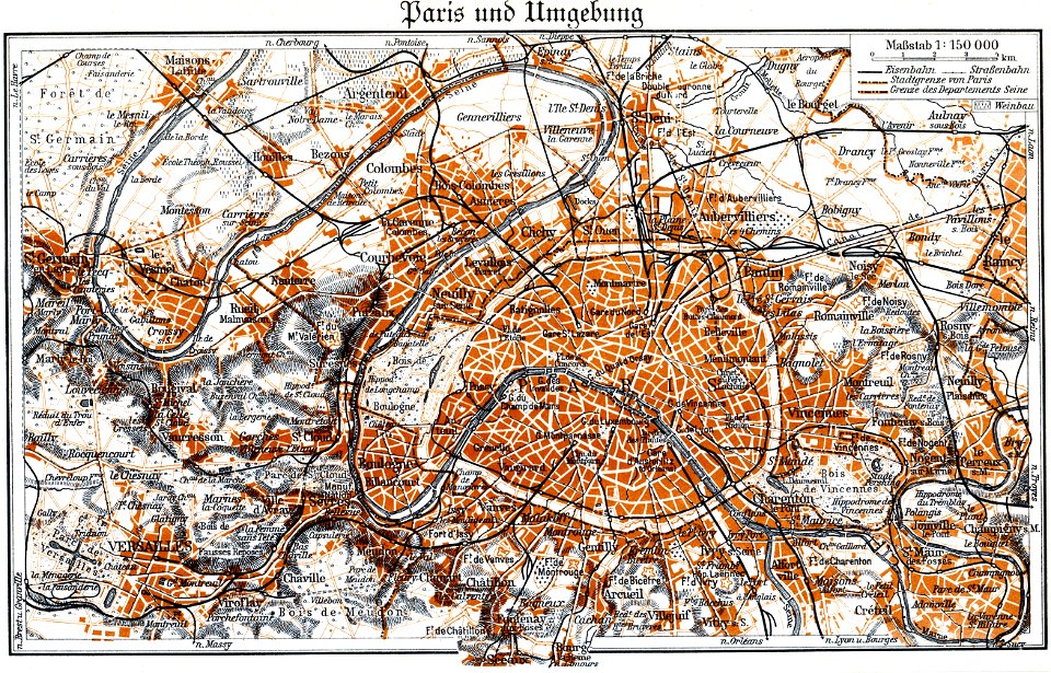
maps by brockhaus
1937 in paris
maps by brockhaus
1937 in paris
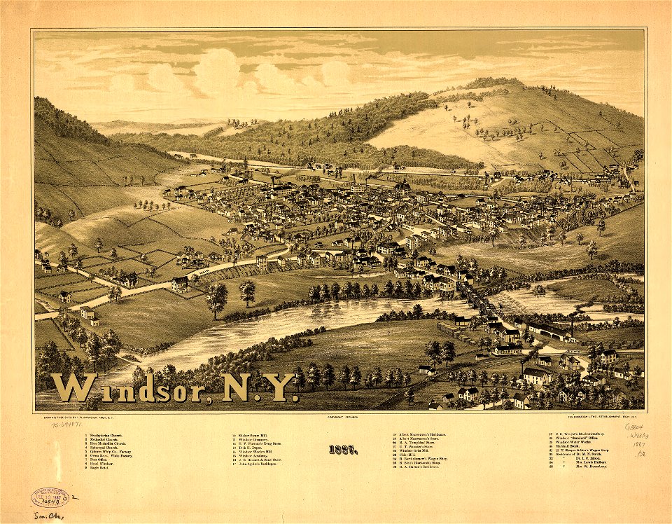
maps in the library of congress
new york
new york
windsor
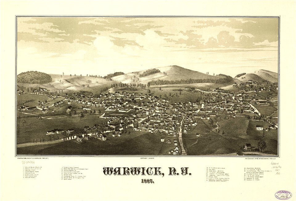
new york
warwick
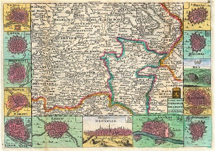
ardennes (belgium)
gallia belgica
maps in utrecht university library
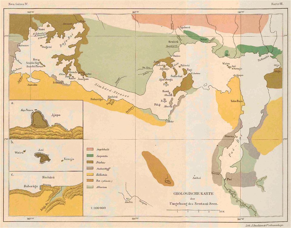
lake sentani
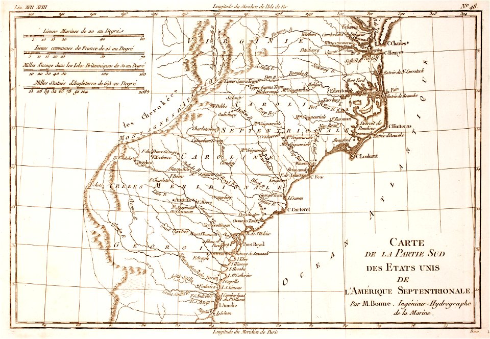
18th-century maps of north carolina
1780 maps
joachim lederlin
jacob züberlein
old maps of south africa
boer
old maps of mexico
pictorial maps
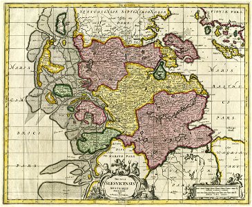
17th-century maps of schleswig-holstein
gerard valck
maps by matthäus seutter
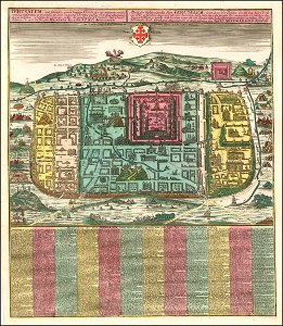
old maps of jerusalem
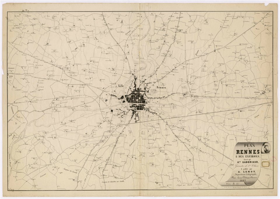
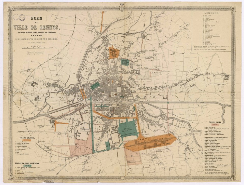
rennes in the 1850s
old maps of rennes
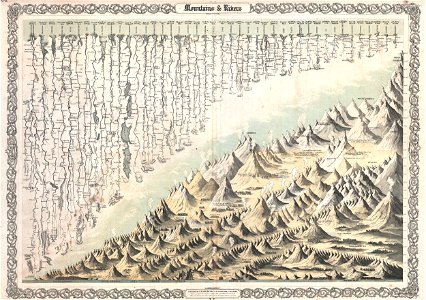
geographic comparison diagrams
diagrams of mountains
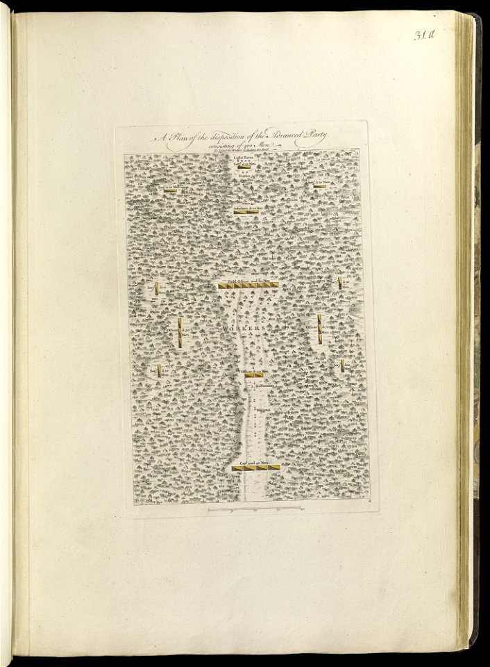
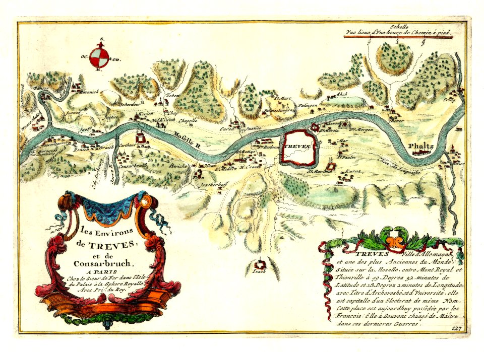
maps of the french and indian war
1768 maps
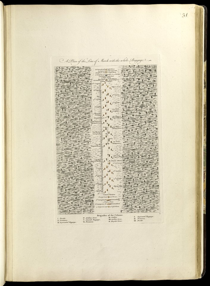
maps of the french and indian war
1768 maps
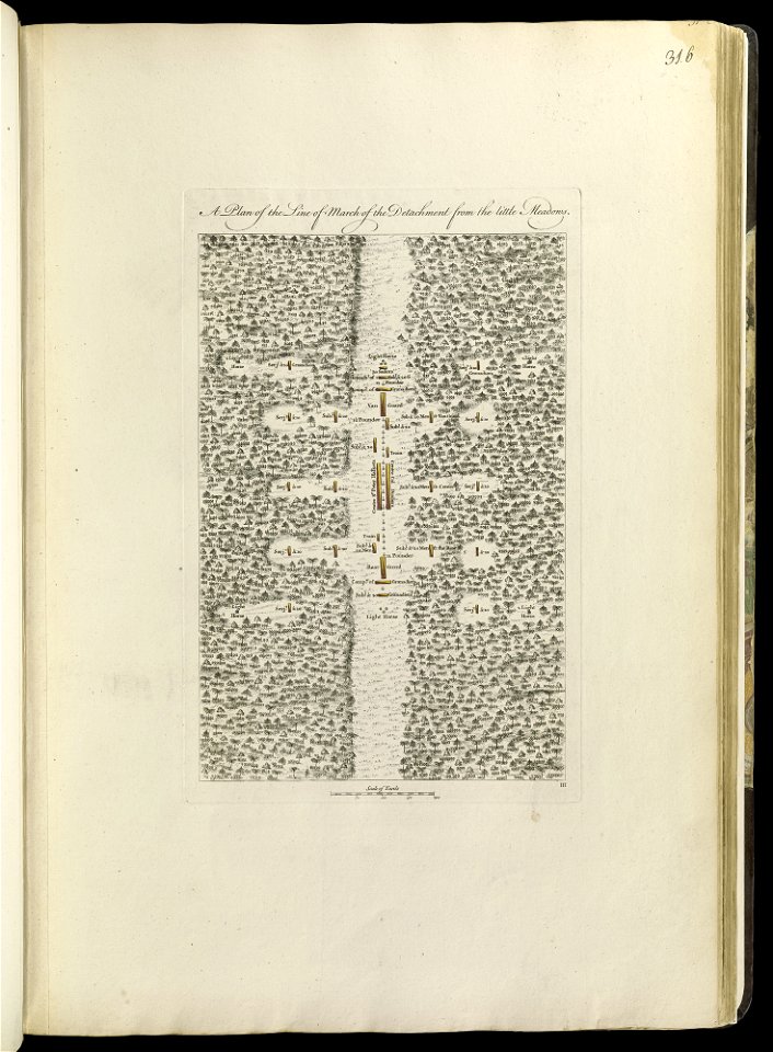
maps of the french and indian war
1768 maps
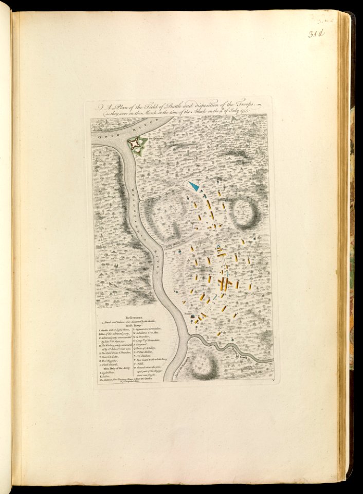
maps of the french and indian war
1768 maps
maps of the french and indian war
1768 maps
maps of the french and indian war
1768 maps
maps of the french and indian war
1786 maps
maps by jacob van deventer
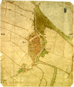
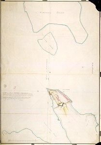
old maps of brielle
maps by frederick de wit
copper engraving
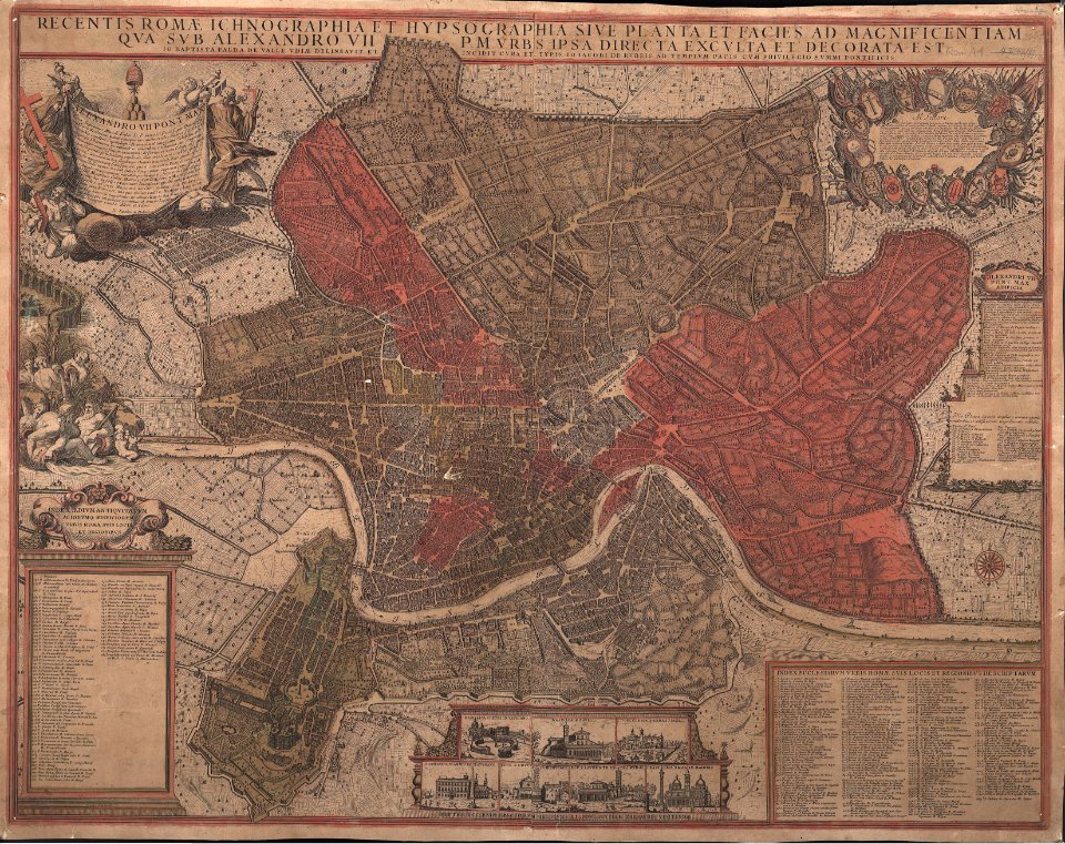
giovanni giacomo de rossi
giovanni battista falda
maps in the stadsarchief amsterdam
old maps of amsterdam
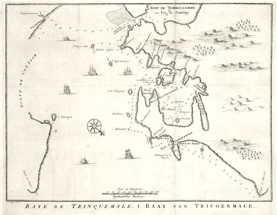
maps of the dutch east india company - sri lanka
1787 maps
maps of the dutch east india company - sri lanka
1753 maps
nicolas de fer
1692 maps
rennes in the 1850s
old maps of rennes
1861 in bretagne
1861 maps
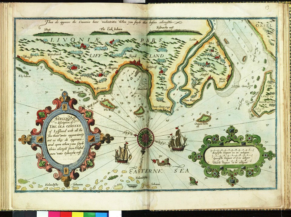
lucas janszoon waghenaer
1588 maps
lucas janszoon waghenaer
1588 maps
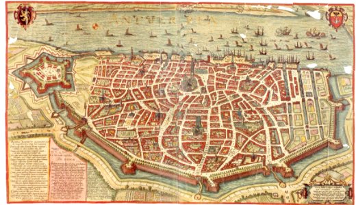
maps and topographical views by joris hoefnagel
maps of antwerp
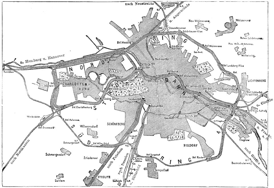
19th-century maps of berlin
maps by brockhaus
atlas van der hagen (volume 2)
maps with cartouches
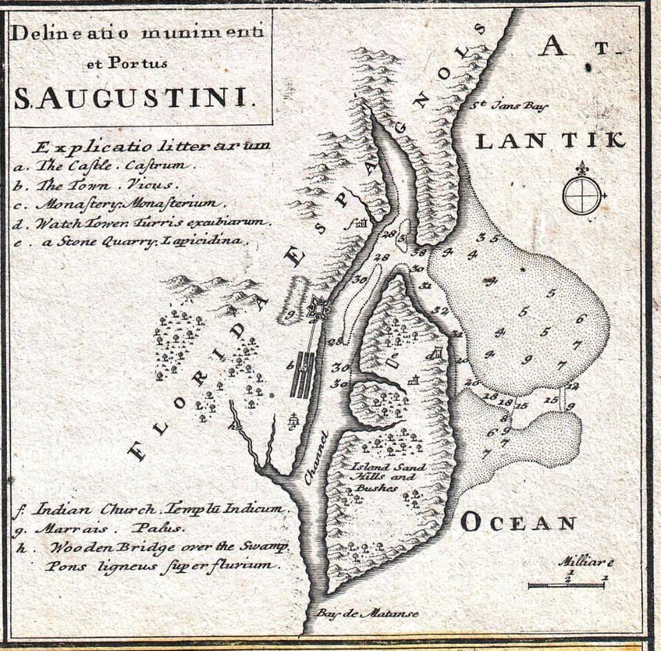
florida
1730s
dutch-language maps
johannes ratelband
hill of tara
1879 maps
1680s maps of baden-württemberg
1681 maps
18th-century maps of berlin
moll's map collection
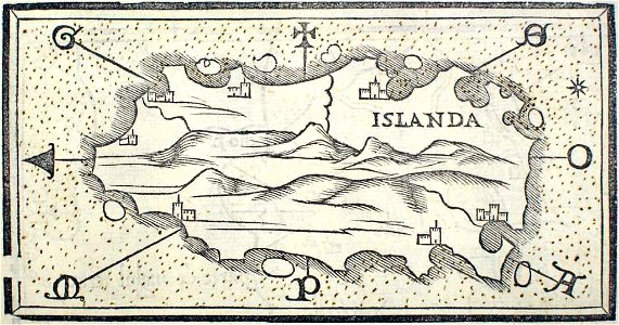
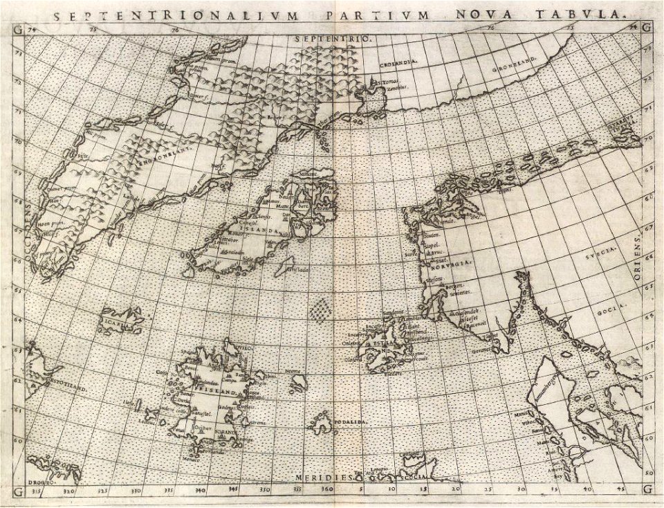
provided by landsbókasafn íslands
maps by giacomo gastaldi
provided by landsbókasafn íslands
16th-century maps of iceland
maps in the stadsarchief amsterdam
old maps of amsterdam
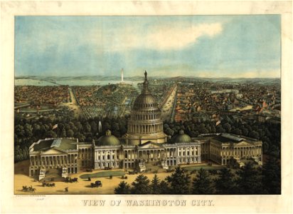
maps in the library of congress
united states capitol in art
maps in the library of congress
united states capitol in art
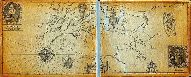
old maps of virginia
captain john smith
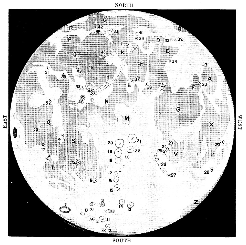
old maps of the moon
1887 maps
16th-century maps of the caribbean
theodor de bry
lucas janszoon waghenaer
1588 maps
provided by landsbókasafn íslands
maps by giacomo gastaldi
provided by landsbókasafn íslands
1561 maps
charts and maps of the royal museums greenwich
1682 maps
maps by willem and johannes blaeu
atlas van loon
maps by willem and johannes blaeu
atlas van loon
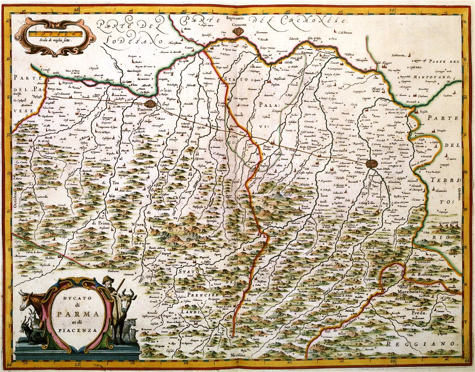
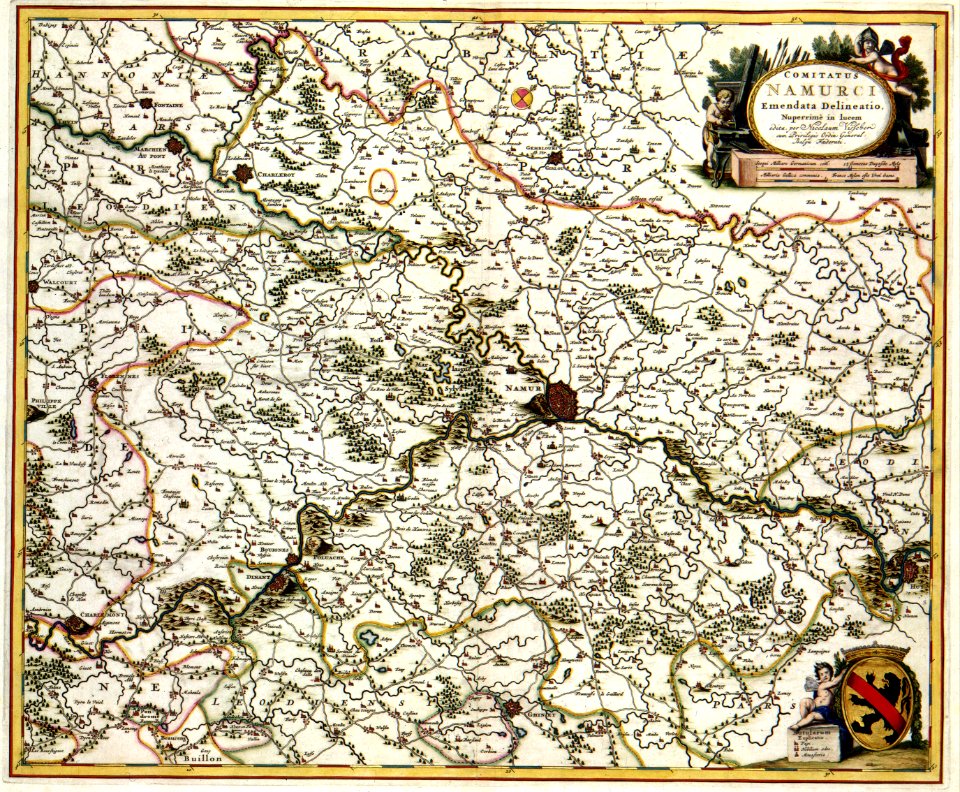
maps made in the 17th century
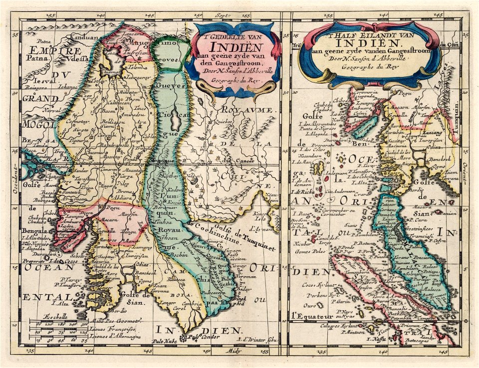
maps by nicolas sanson
maps made in the 17th century
maps by nicolas sanson
maps made in the 17th century
maps by johannes janssonius
illustrated battles of the nineteenth century
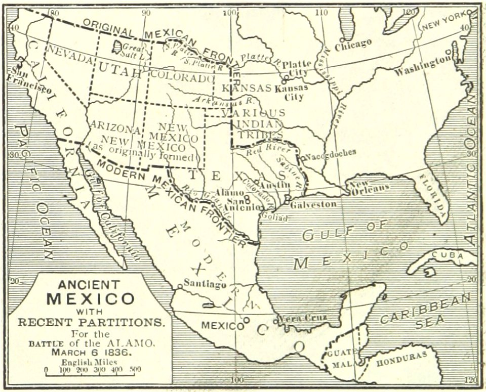
maps of the history of mexico
old maps of the saint lawrence river
old maps of new england
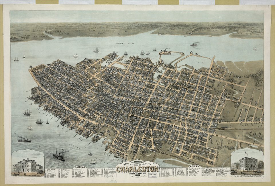
south carolina
charleston
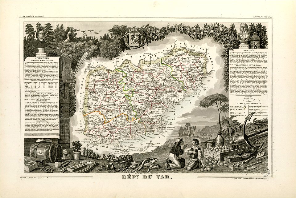
coats of arms of cities in var
old maps of var
3801 - 3900 of 1,095,866
Next page
/ 10959